Vegetation Indices
Overview
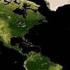
MODIS vegetation indices, produced on 16-day intervals and at multiple spatial resolutions, provide consistent spatial and temporal comparisons of vegetation canopy greenness, a composite property of leaf area, chlorophyll and canopy structure. Two vegetation indices are derived from atmospherically-corrected reflectance in the red, near-infrared, and blue wavebands: the normalized difference vegetation index (NDVI), which provides continuity with NOAA's AVHRR NDVI time series record for historical and climate applications, and the enhanced vegetation index (EVI), which minimizes canopy-soil variations and improves sensitivity over dense vegetation conditions. The two products more effectively characterize the global range of vegetation states and processes. The vegetation indices are retrieved from daily, atmosphere-corrected, bidirectional surface reflectance. The VI's use a MODIS-specific compositing method based on product quality assurance metrics to remove low quality pixels. From the remaining good quality VI values, a constrained view angle approach then selects a pixel to represent the compositing period (from the two highest NDVI values it selects the pixel that is closest-to-nadir). Because the MODIS sensors aboard Terra and Aqua satellites are identical, the VI algorithm generates each 16-day composite eight days apart (phased products) to permit a higher temporal resolution product by combining both data records. The MODIS VI product suite is now used successfully in all ecosystem, climate, and natural resources management studies and operational research as demonstrated by the ever increasing body of peer publications.
Product Information
- Kamel Didan
- Stage 3
- Product Home Page Link
- User Guide
- ATBD
- Validation
-
DOI
- refer to individual product page (below) for the appropriate DOI , citation text, and file spec for that product
Product Details
| Product Name | Terra | Aqua |
|---|---|---|
| Vegetation Indices 16-Day L3 Global 250m |
|
|
| Vegetation Indices 16-Day L3 Global 500m |
|
|
| Vegetation Indices 16-Day L3 Global 1km |
|
|
| Vegetation Indices 16-Day L3 Global 0.05Deg CMG |
|
|
| Vegetation Indices Monthly L3 Global 1km |
|
|
| Vegetation Indices Monthly L3 Global 0.05Deg CMG |
|
|