Evapotranspiration
Overview
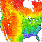
This project is part of NASA/EOS project to estimate global terrestrial evapotranspiration from earth land surface by using satellite remote sensing data. MOD16 global evapotranspiration product can be used to calculate regional water and energy balance, soil water status; hence, it provides key information for water resource management. With long-term ET data, the effects of changes in climate, land use, and ecosystems disturbances (e.g. wildfires and insect outbreaks) on regional water resources and land surface energy change can be quantified. The MOD16 global evapotranspiration (ET)/latent heat flux (LE)/potential ET (PET)/potential LE (PLE) datasets are regular 1-km2 land surface ET datasets for the 109.03 Million km2 global vegetated land areas at 8-day, monthly and annual intervals. The dataset covers the time period 2000 through 2010. Future years will be produced and posted periodically, but not in near-real time.
Product Information
- Steve Running
- Product Home Page Link
- ATBD
-
DOI
- refer to individual product page (below) for the appropriate DOI , citation text, and file spec for that product
Product Details
| Product Name | Terra | Aqua |
|---|---|---|
| Net Evapotranspiration 8-Day L4 Global 500m |
|
|
| Net Evapotranspiration Yearly L4 Global 500m |
|
|