Long-term Data Record
The Long-Term Data Record (LTDR) project was originally funded through a NASA Research, Education, and Applications Solutions Network (REASoN) program in 2002, and a NASA Making Earth System Data Records for Use in Research Environments (MEaSUREs) project in 2010. Currently, LTDR is funded by a MEaSUREs 2017 project and the Climate Data Record (CDR) Program from the NOAA National Climatic Data Center. With Eric Vermote as its Principal Investigator, this project continues to produce and distribute a global land surface climate data record (CDR) that is critically important to studying global climate change. The LTDR project serves as a bridge that connects data derived from the NOAA Advanced Very-High-Resolution Radiometer (AVHRR), the EOS Moderate resolution Imaging Spectroradiometer (MODIS), the Suomi National Polar-orbiting Partnership (SNPP) Visible Infrared Imaging Radiometer Suite (VIIRS), and NOAA (JPSS) VIIRS missions. Starting in 1981, the LTDR offers a wide temporal extent of data products that span multiple decades.
Introduction
 The LTDR project produces, validates, and distributes a global land surface CDR that uses both
mature and well-tested algorithms in concert with the best-available polar-orbiting satellite data
from past to the present. The LAADS DAAC hosts the LTDR collections that include top-of-atmosphere
reflectance, surface reflectance, and vegetation index products. The LTDR project currently
leverages AVHRR, MODIS, and VIIRS data sources. LTDR draws from the following eight AVHRR missions:
MetOp-B1, NOAA-19, NOAA-18, NOAA-16, NOAA-14, NOAA-11, NOAA-09, and NOAA-07. Currently,
the project
generates a daily surface reflectance product as the fundamental climate data record (FCDR) and
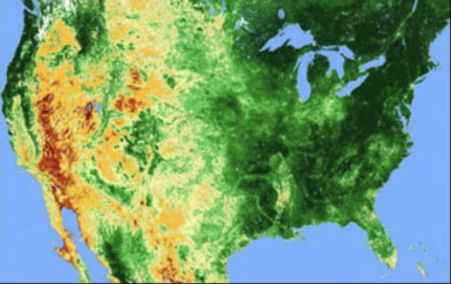
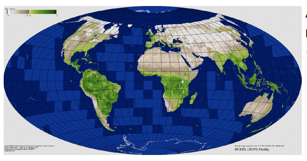
derives a daily Normalized Differential Vegetation Index (NDVI) product.
The LTDR project produces, validates, and distributes a global land surface CDR that uses both
mature and well-tested algorithms in concert with the best-available polar-orbiting satellite data
from past to the present. The LAADS DAAC hosts the LTDR collections that include top-of-atmosphere
reflectance, surface reflectance, and vegetation index products. The LTDR project currently
leverages AVHRR, MODIS, and VIIRS data sources. LTDR draws from the following eight AVHRR missions:
MetOp-B1, NOAA-19, NOAA-18, NOAA-16, NOAA-14, NOAA-11, NOAA-09, and NOAA-07. Currently,
the project
generates a daily surface reflectance product as the fundamental climate data record (FCDR) and
derives a daily Normalized Differential Vegetation Index (NDVI) product.
LTDR uses the best-available data, addressing the dynamic data continuity of the input observations from AVHRR and MODIS with different spatial resolutions that include the following:
- AVHRR Global Area Coverage (GAC): 4 km (1981 – present)
- AVHRR High Resolution Picture Transmission (HRPT): 1 km (1992 – 1998)
- AVHRR Local Area Coverage (LAC): 1 km (1992 – 1998)
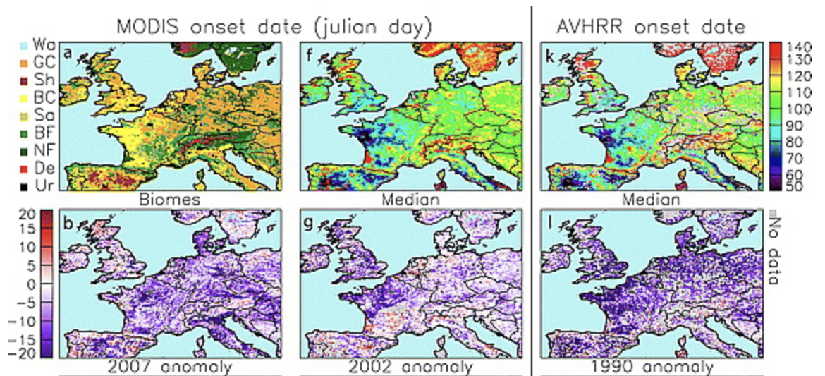
The GAC data products from the AVHRR sensors onboard the NOAA satellites from 1981 - present are reprocessed by applying the preprocessing improvements identified in the AVHRR Pathfinder II project, and the atmospheric corrections used in the MODIS preprocessing. The project compares the AVHRR results with MODIS products where the two instruments overlap in time (from 2000 on for Terra/MODIS, and from mid-2002 for Aqua/MODIS). Gaps in the data record from these two instruments are filled using a 1-km SPOT VEGETATION surface reflectance product generated by the European Geoland2 project.
1 MetOp-B (Meteorological Operational Satellite) is part of a series of three polar-orbiting meteorological satellites that were developed by the European Space Agency, and operated by the European Organisation for the Exploitation of Meteorological Satellites (EUMETSAT).
Aim/Objectives
The primary aim of the LTDR project is to produce, validate, and distribute a global land surface fundamental climate data record (FCDR) using a combination of mature and well-tested algorithms, and the best available polar-orbiting satellite data from the past to the present. When the LTDR project began, the data record started with the NOAA AVHRR through the Terra and Aqua MODIS missions and continues into the SNPP and NOAA (JPSS) VIIRS missions as well. LTDR's portfolio consists of one fundamental climate data record (FCDR), the surface reflectance product, and a thematic CDR (TCDR) derived from the FCDR, which is the NDVI product.
Benefits
The LTDR project leverages over four decades of institutional knowledge to render AVHRR data products spectrally and temporally consistent with MODIS through reliable and consistent calibration across the different NOAA platforms, bidirectional reflectance distribution function (BRDF) corrections, and MODIS algorithms-driven aerosol retrieval and atmospheric correction processes. Therefore, the LTDR project's ability to promote coincidence between AVHRR and MODIS helps improve the AVHRR products and their accuracy and produce and distribute a validated surface reflectance FCDR and NDVI TCDR, as important Essential Climate Variables (ECV) for climate-change research.
Output products
Top-of-Atmosphere Reflectance
| Satellite | Product |
|---|---|
|
MetOp-B
|
|
|
NOAA-19
|
|
|
NOAA-18
|
|
|
NOAA-16
|
|
|
NOAA-14
|
|
|
NOAA-11
|
|
|
NOAA-09
|
|
|
NOAA-07
|
|
Surface Reflectance
| Satellite | Product |
|---|---|
|
MetOp-B
|
|
|
NOAA-19
|
|
|
NOAA-18
|
|
|
NOAA-16
|
|
|
NOAA-14
|
|
|
NOAA-11
|
|
|
NOAA-09
|
|
|
NOAA-07
|
|
NDVI
| Satellite | Product |
|---|---|
|
MetOp-B
|
|
|
NOAA-19
|
|
|
NOAA-18
|
|
|
NOAA-16
|
|
|
NOAA-14
|
|
|
NOAA-11
|
|
|
NOAA-09
|
|
|
NOAA-07
|
|
Project documentation
| LTDR IGARSS 2007 paper | LTDR paper presented at the 2007 IGARSS |
| AGU Fall 2009 presentation | LTDR presentation at the 2009 Fall AGU |
| IGARSS 2007 presentation | LTDR presentation at the 2007 IGARSS |
| LTDR Montana Veg. Workshop | LTDR presentation, 2006 Global Veg. Workshop, MT |
| AGU Fall 2005 presentation | LTDR presentation, NPOESS session, 2005 Fall AGU |
| MODIS STM 2004 presentation | LTDR presentation, MODIS Sci. Team Meeting, 2004 |
| LTDR 2007 Workshop | LTDR presentations, 2007 Workshop, College Park, MD |
| LTDR V5 User Guide | LTDR AVHRR V5 Products User Guide, 2021 |
Citation Information
If you happen to incorporate LTDR products in your research, please use the following acknowledgment within your published work:
“These data products are processed and distributed by the MEaSUREs Long-Term Data Record project by the Level-1 and Atmosphere Archive & Distribution System (LAADS) Distributed Active Archive Center (DAAC) at the Goddard Space Flight Center.” If possible, please e-mail or send us reprints/citations of papers or oral presentations that are based on LTDR products (see below for email and mailing address). This will help us to stay informed regarding how our data are being used.
There are no restrictions for use of data from the LTDR project unless otherwise expressly stated. If you have any questions, please contact us.
Related Links
- LTDR Principal Investigator: Eric Vermote
- LTDR AVHRR Products (Version 6) User Guide
- LTDR Global Browse
- LTDR Time Series
- LTDR Known Product Issues
- LTDR Version History